Gréo Kilomètre Vertical
Gréolières, Alpes-Maritimes, FR
Min Elevation
1401m
Max Elevation
1757m
Elevation Gain
351m
Elevation Loss
2m
Distance
1.8 km
Est. Time
-
About this Track
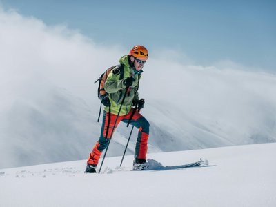
Ski touring route for experienced levels in Gréolières les Neiges up to the Cheiron Summit. Departure is from the snow front, opposite the Cheiron Cafeteria. After enjoying the 360° view at the summit, the descent is made via the ski slopes back to the snow front. Route details: Go up the red 'Lièvre' slope on the right-hand side at the edge of the Scots pine forest. Please note, this is a very busy ski slope, so please respect the markings dedicated to ski tourers. At the top of the first wall, at an altitude of 1600m, you cross the 'Tétras' slope, cross the flat area and begin the climb of the second wall, staying on the right-hand side of the 'Marmottes' slope. Exit at the summit of Cheiron via a final flat area; the orientation table is on your left. From here, the view is 360° and takes in the Haut-Var/Haut-Verdon, the Mercantour, the Côte d'Azur from Monaco to Saint-Tropez and perhaps Corsica on clear winter days.
Location
- Country FR
- State/Region Alpes-Maritimes
- City 06620 Gréolières
- Latitude 43.829620
- Longitude 6.967880
Photos
Community Photos
Photos shared by community members
No community photos yet. Be the first to share!
Login to upload photosNo photos available for this track.
Additional Information
Parking: Gréolières Snow Front
Access: Gréolières Snow Front, Gréolières
Safety: Ski touring route for experienced levels. Please respect the markings dedicated to ski tourers.
Source
View Original SourceContact Information
Contact Details
-
Phone +33 (0)4 93 23 30 30
-
Email contact@greolieres.fr
Elevation Profile
Loading elevation data...
Track Conditions
No condition reports yet. Be the first to report!