Gröbner Hals
Achenkirch, Tyrol, AT
Min Elevation
-
Max Elevation
1654m
Elevation Gain
725m
Elevation Loss
7m
Distance
4.5 km
Est. Time
2h15
About this Track
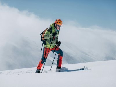
Short but very rewarding tour in the Karwendel mountains with great views. The route leads from Achenkirch through the Unterautal valley. The ascent follows a forest road to the Gröbenalm and then over alpine meadows to the Gröbner Hals. It offers fantastic views of the Karwendel peaks and the Guffert.
Location
- Country AT
- State/Region Tyrol
- City 6215 Achenkirch
- Latitude 47.514580
- Longitude 11.696630
Photos
Community Photos
Photos shared by community members
No community photos yet. Be the first to share!
Login to upload photosNo photos available for this track.
Additional Information
Parking: Mosen car park in Achenkirch (paid parking)
Access: Regional bus 4080 to stop 'Achenkirch Mosen'.
Safety: Standard winter equipment. Generally safe from avalanches on the main route, but always check local reports.
Source
View Original SourceContact Information
Achensee Tourismus
TirolTourism board for Tirol's largest lake in Austria
Contact Details
-
Address Achenseestraße 63
6212 Maurach am Achensee
AT -
Phone +43 5 95300-0
-
Email info@achensee.com
-
Website Visit Website
Elevation Profile
Loading elevation data...
Track Conditions
No condition reports yet. Be the first to report!