La Bourri Blue
Torgon, Valais, CH
Min Elevation
1332m
Max Elevation
1591m
Elevation Gain
259m
Elevation Loss
2m
Distance
2.5 km
Est. Time
55min
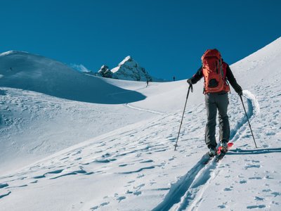
About this Track
Perfect route for a first ski touring outing or an introduction to this sport. Starting from Plan de Croix parking, your efforts after less than 259m of positive elevation gain will be rewarded with a stop at the Bourri refreshment stand. Enjoy a gourmet break and admire the scenery.
Location
- Country CH
- State/Region Valais
- City 1899 Torgon
- Latitude 46.306205
- Longitude 6.850537
Photos
Community Photos
Photos shared by community members
No community photos yet. Be the first to share!
Login to upload photosNo photos available for this track.
Additional Information
Parking: Plan de Croix
Access: Plan de Croix parking
Safety: Marked route. Consult the avalanche bulletin.
Source
View Original SourceContact Information
Torgon Tourisme
ValaisTourism office for Torgon, gateway to the Portes du Soleil
Contact Details
-
Address Place de la Jorette
1899 Torgon
CH -
Phone +41 24 481 31 31
-
Email info@torgon.ch
-
Website Visit Website
Elevation Profile
Loading elevation data...
Track Conditions
No condition reports yet. Be the first to report!