La Franco-Suisse
Châtel, Haute-Savoie / Valais, CH
Min Elevation
1639m
Max Elevation
1847m
Elevation Gain
200m
Elevation Loss
143m
Distance
4.5 km
Est. Time
2h
About this Track
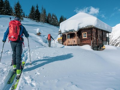
Ideal for beginners, this itinerary starts at the top of the Super-Châtel gondola. Follow the pedestrian path towards Lac de Conche until the Chalet Neuf drag lift intersection. The route then continues through the forest to Col de Culet, offering a magnificent panorama of the Dents du Midi. Descent is via the blue slope 'le Lac'.
Location
- Country CH
- State/Region Haute-Savoie / Valais
- City 74390 Châtel
- Latitude 46.267551
- Longitude 6.858066
Photos
Community Photos
Photos shared by community members
No community photos yet. Be the first to share!
Login to upload photosNo photos available for this track.
Additional Information
Parking: Village center parking in Châtel
Access: Access via the Super-Châtel gondola from the village.
Safety: The final descent must be made before 16:30. Subject to snow conditions.
Source
View Original SourceContact Information
Châtel Tourisme / Portes du Soleil
Haute-SavoieTourist office for the family-friendly Châtel resort in the Portes du Soleil
Contact Details
-
Address 14 route de Thonon, BP 40
74390 Châtel
FR -
Phone +33 (0)4 50 73 22 44
-
Email touristoffice@chatel.com
-
Website Visit Website
Elevation Profile
Loading elevation data...
Track Conditions
No condition reports yet. Be the first to report!