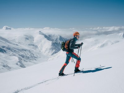
La Roche - Le Fornelet
La Plagne, Savoie, FR
Min Elevation
1634m
Max Elevation
1972m
Elevation Gain
485m
Elevation Loss
350m
Distance
3.5 km
Est. Time
-
About this Track
A route to become familiar with ski touring techniques such as kick turns. It is suitable for occasional ski tourers as well as seasoned athletes looking for training. The path crosses the forest, passes through the Pra Véry clearing, then joins the Bief Bovet path before finishing along the Adrets slope to the summit.
Location
- Country FR
- State/Region Savoie
- City 73210 La Plagne
- Latitude 45.523656
- Longitude 6.631766
Photos
Community Photos
Photos shared by community members
No community photos yet. Be the first to share!
Login to upload photosNo photos available for this track.
Additional Information
Parking: La Roche
Access: Near the departure of the La Roche chairlift
Safety: Descent recommended via blue slopes. Note shared sections with alpine ski slopes.
Source
View Original SourceContact Information
Office de Tourisme de La Grande Plagne
Auvergne-Rhône-AlpesTourism office for La Plagne ski resort
Contact Details
-
Address B.P. 4
73210 Aime-la-Plagne
FR -
Phone +33 (0)4 79 09 02 01
-
Email info@la-plagne.com
-
Website Visit Website
Elevation Profile
Loading elevation data...
Track Conditions
No condition reports yet. Be the first to report!