La trace du Bois de Veyrières
Le Lioran, Cantal, FR
Min Elevation
1244m
Max Elevation
1814m
Elevation Gain
650m
Elevation Loss
34m
Distance
5.6 km
Est. Time
-
About this Track
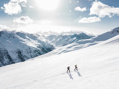
The route begins with 'La trace du Bois de Veyrières' (to the right of the Gardes chairlift) and continues on the 'Georges Bouvet' slope. These trails allow you to discover our Volcano, its protected flora (anemones, martagon lilies…) and its fauna (mouflons, chamois, marmots). Descents are via the alpine ski area.
Location
- Country FR
- State/Region Cantal
- City 15300 Le Lioran
- Latitude 45.080550
- Longitude 2.748430
Photos
Community Photos
Photos shared by community members
No community photos yet. Be the first to share!
Login to upload photosNo photos available for this track.
Additional Information
Parking: Prairie des Sagnes
Access: Departure from Le Lioran - Prairie des Sagnes
Safety: Routes open from 9am to 5pm depending on conditions. Openings/closings communicated by the slope service. Reserved for uphill climbing.
Source
View Original SourceContact Information
Hautes Terres Tourisme
Auvergne-Rhône-AlpesTourism office for the Cantal region, including Le Lioran
Contact Details
-
Address Place du Château
15300 Murat
FR -
Phone +33 4 71 20 09 47
-
Website Visit Website
Elevation Profile
Loading elevation data...
Track Conditions
No condition reports yet. Be the first to report!