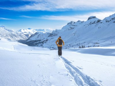
Estaris Lake
Orcières, Provence-Alpes-Côte d'Azur, FR
Min Elevation
1887m
Max Elevation
2592m
Elevation Gain
676m
Elevation Loss
61m
Distance
5.0 km
Est. Time
2h
About this Track
Starting from the groomer garage, this off-the-beaten-track route will take you to emblematic areas of the resort: the Jujal plateau, the Rocherousse plateau, and numerous lakes. The route is an invitation to contemplation and gentle skiing. The tour ends at the top of the Estaris chairlift, overlooking the lake of the same name. Finally, descend via the 'Sirènes' blue slope.
Location
- Country FR
- State/Region Provence-Alpes-Côte d'Azur
- City 05170 Orcières
- Latitude 44.700298
- Longitude 6.329650
Photos
Community Photos
Photos shared by community members
No community photos yet. Be the first to share!
Login to upload photosNo photos available for this track.
Additional Information
Parking: Orcières Merlette 1850 resort parking
Access: Departure from the groomer garage
Safety: Marked route (blue flags n°1). Descent via the slopes. Consult the avalanche bulletin.
Source
View Original SourceContact Information
Office de Tourisme d'Orcières Merlette 1850
Provence-Alpes-Côte d'AzurTourism Office for Orcières Merlette 1850
Contact Details
-
Address Place des Drapeaux
05170 Orcières
FR -
Phone +33 4 92 55 89 89
-
Email info@orcieres.com
-
Website Visit Website
Elevation Profile
Loading elevation data...
Track Conditions
No condition reports yet. Be the first to report!