Le Planey / Porcherey
Saint-Gervais-les-Bains, Haute-Savoie, FR
Min Elevation
1172m
Max Elevation
1699m
Elevation Gain
573m
Elevation Loss
-
Distance
3.6 km
Est. Time
1h20
About this Track
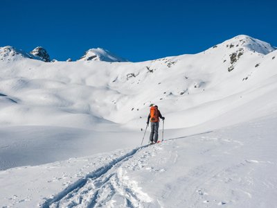
Magnificent route with a view of Mont Blanc. The climb begins at the end of the hamlet of Carteyron, crosses the Nant des Meuniers forest on a winding path to reach the Croix du Porcherey. The descent is via the Marmottes red run then the Chattrix blue run.
Location
- Country FR
- State/Region Haute-Savoie
- City 74170 Saint-Gervais-les-Bains
- Latitude 45.850750
- Longitude 6.723710
Photos
Community Photos
Photos shared by community members
No community photos yet. Be the first to share!
Login to upload photosNo photos available for this track.
Additional Information
Parking: Parking opposite the road leading up to the Plateau de la Croix
Access: 1.5 km approach walk on the route de la Corniche from the car park.
Safety: Unsecured and uncontrolled route. Check the avalanche bulletin (PIDA possible).
Source
View Original SourceContact Information
Saint-Gervais Mont-Blanc Tourisme
Auvergne-Rhône-AlpesTourism Office for Saint-Gervais Mont-Blanc
Contact Details
-
Address 43 rue du Mont-Blanc
74170 Saint-Gervais-les-Bains
FR -
Phone +33 (0)4 50 47 76 08
-
Website Visit Website
Elevation Profile
Loading elevation data...
Track Conditions
No condition reports yet. Be the first to report!