'MYET' Red Trail
Morgins, Valais, CH
Min Elevation
1312m
Max Elevation
2041m
Elevation Gain
750m
Elevation Loss
88m
Distance
6.1 km
Est. Time
2h30
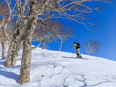
About this Track
Test your mettle on a real ski mountaineering race course - the Morgins' Yannick Ecoeur Trophy. This technical red trail includes passages through the trees where you will need to perform a few kick-turns. Two options: shortcut to Crêtes Ridge (~600m D+) or full route to Aiguille des Champeys (800m D+).
Location
- Country CH
- State/Region Valais
- City 1875 Morgins
- Latitude 46.236630
- Longitude 6.856710
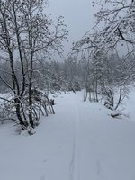
Photos
Community Photos 1
Photos shared by community members
Additional Information
Parking: Parking du 6 Août
Access: Place du 6 Août, Morgins
Safety: Technical trail with kick-turns, flat sections, steep hills. Carry avalanche equipment.
Source
View Original SourceContact Information
Part of the Région Dents du Midi, focusing on Morgins and Portes du Soleil
Contact Details
-
Address Route de France 15
1875 Morgins
CH -
Phone +41 24 477 23 61
-
Email morgins@rddm.ch
-
Website Visit Website
Elevation Profile
Loading elevation data...