Savolaire Blue Trail
Morgins, Valais, CH
Min Elevation
1313m
Max Elevation
1899m
Elevation Gain
650m
Elevation Loss
130m
Distance
6.7 km
Est. Time
2h10
About this Track
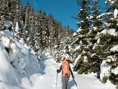
A wide, easy trail with gentle slope and beautiful views. Starting from Place du 6 Août car park, follow the wide track to sunny Savolaire Plain (Champarin), then climb across the field past the Buvette de Savolaire chalet (closed in winter) to the Swiss Alpine Club chalet. Descend to Col du Madzé, climb through fields to join the red Abérieu trail, then take the ridge to the top station of the gondola lift. Ski back down the Foilleuse slope.
Location
- Country CH
- State/Region Valais
- City 1875 Morgins
- Latitude 46.236590
- Longitude 6.856780
Photos
Community Photos
Photos shared by community members
No community photos yet. Be the first to share!
Login to upload photosNo photos available for this track.
Additional Information
Parking: Parking du 6 Août, next to tourist office
Access: Place du 6 Août, Morgins village center
Safety: Trails marked but not patrolled. Carry avalanche safety equipment (transceiver, probe, shovel, emergency blanket). Ski runs closed outside lift hours (before 8:30am, after 4:30pm) except Foilleuse (until 9:30pm).
Source
View Original SourceContact Information
Part of the Région Dents du Midi, focusing on Morgins and Portes du Soleil
Contact Details
-
Address Route de France 15
1875 Morgins
CH -
Phone +41 24 477 23 61
-
Email morgins@rddm.ch
-
Website Visit Website
Elevation Profile
Loading elevation data...
Track Conditions
No condition reports yet. Be the first to report!