Day Ski Touring Slope Pizol
Bad Ragaz, St. Gallen, CH
Min Elevation
1627m
Max Elevation
2224m
Elevation Gain
598m
Elevation Loss
12m
Distance
3.3 km
Est. Time
1h40
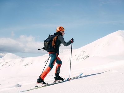
About this Track
The perfect training opportunity for ski tourers: a specially prepared ascent track over 3.2 kilometers. Starting from Pardiel, the route leads to Laufböden. It offers a unique view of the Rhine Valley as far as Lake Constance. The second part of the hike follows the unprepared but secured downhill route to Laufböden. Descent is via regular slopes (Zanuz, Tritt, or See-Egg).
Location
- Country CH
- State/Region St. Gallen
- City 7310 Bad Ragaz
- Latitude 46.989627
- Longitude 9.463681
Photos
Community Photos
Photos shared by community members
No community photos yet. Be the first to share!
Login to upload photosNo photos available for this track.
Additional Information
Parking: Valley station Pizolbahnen Bad Ragaz
Access: Gondola from Bad Ragaz to Pardiel.
Safety: Closed at night for slope preparation. Cross slopes only at designated points. Follow FIS rules.
Source
View Original SourceContact Information
Pizolbahnen AG
St. GallenOperator of the cable car and ski area in the Pizol region
Contact Details
-
Address Loisstrasse 50
7310 Bad Ragaz
CH -
Phone +41 81 300 48 30
-
Email info@pizol.com
-
Website Visit Website
Elevation Profile
Loading elevation data...
Track Conditions
No condition reports yet. Be the first to report!