Plan du Fou
Haute-Nendaz, Valais, CH
Min Elevation
1329m
Max Elevation
2441m
Elevation Gain
709m
Elevation Loss
-
Distance
3.8 km
Est. Time
2h
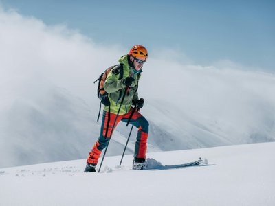
About this Track
This varied route crosses the forest and the mountain pasture of Siviez. There are a few technical sections on the second part of the route, but the effort is worth it! A sunny terrace awaits you upon arrival.
Location
- Country CH
- State/Region Valais
- City 1997 Haute-Nendaz
- Latitude 46.138042
- Longitude 7.316348
Photos
Community Photos
Photos shared by community members
No community photos yet. Be the first to share!
Login to upload photosNo photos available for this track.
Additional Information
Parking: Siviez main car park
Access: Siviez
Safety: Look at the safety instructions before your departure. The ski runs are open solely during the operating hours of the ski lifts.
Source
View Original SourceContact Information
Nendaz Tourisme
ValaisInformation center for the Haute-Nendaz and 4 Vallées region
Contact Details
-
Address Route de la Télécabine 1
1997 Haute-Nendaz
CH -
Phone +41 27 289 55 89
-
Email info@nendaz.ch
-
Website Visit Website
Elevation Profile
Loading elevation data...
Track Conditions
No condition reports yet. Be the first to report!