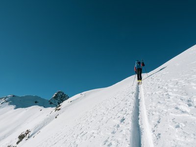
Plum Moontain Race
Courchevel, Savoie, FR
Min. Höhe
-
Max. Höhe
-
Höhenmeter
420m
Abstieg
-
Entfernung
3,0 km
Vorauss. Zeit
1h15
Über diese Tour
Located at the intersection of Courchevel and Méribel, this route leads to Col de la Loze. It offers 360° views of the 3 Vallées from the orientation table at the summit.
Standort
- Land FR
- Bundesland/Region Savoie
- Stadt 73120 Courchevel
- Breitengrad 45,423547
- Längengrad 6,640623
Fotos
Community-Fotos
Von Community-Mitgliedern geteilte Fotos
Noch keine Community-Fotos. Seien Sie der Erste, der welche teilt!
Anmelden, um Fotos hochzuladenKeine Fotos für diese Tour verfügbar.
Zusätzliche Informationen
Parking: Courchevel 1850 car parks
Access: At the start, go up the 'Déviation 1550' piste to the right of the Plantrey chairlift.
Safety: Follow specific marking. In case of low snow, use the Millet route.
Quelle
Originalquelle ansehenKontaktinformationen
Courchevel Tourisme
Auvergne-Rhône-AlpesMain tourism office for the prestigious Courchevel resort
Kontaktdaten
-
Adresse 9 rue de l'Église
73120 Courchevel
FR -
Telefon +33 (0)4 79 08 00 29
-
E-Mail info@courchevel.com
-
Webseite Webseite besuchen
Höhenprofil
Höhendaten werden geladen...
Touren-Bewertungen
Noch keine Bewertungen. Seien Sie der Erste, der diese Tour bewertet!
Tourenbedingungen
Noch keine Zustandsberichte. Seien Sie der Erste, der berichtet!