Djeu des Têtes Noires
Torgon, Valais, CH
Min. Höhe
1141m
Max. Höhe
1724m
Höhenmeter
829m
Abstieg
890m
Entfernung
7,4 km
Vorauss. Zeit
3h35
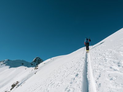
Über diese Tour
Ein herrlicher Ausflug für Begeisterte! Diese schwarze Route führt Sie zur Vieilles-Hütte bis zum Gipfel der Jorette, vorbei an der Dravers-Alm. Diese Route ist perfekt für einen Halbtagesausflug. Genießen Sie die Einrichtungen von Plan de Croix für eine wohlverdiente Pause nach Ihren Anstrengungen.
Standort
- Land CH
- Bundesland/Region Valais
- Stadt 1899 Torgon
- Breitengrad 46,315016
- Längengrad 6,851021
Fotos
Community-Fotos
Von Community-Mitgliedern geteilte Fotos
Noch keine Community-Fotos. Seien Sie der Erste, der welche teilt!
Anmelden, um Fotos hochzuladenKeine Fotos für diese Tour verfügbar.
Zusätzliche Informationen
Parking: Plan de Croix
Access: Plan de Croix
Safety: Anspruchsvolle Route. Lawinenbulletin konsultieren. Notfallausrüstung erforderlich.
Quelle
Originalquelle ansehenKontaktinformationen
Torgon Tourisme
ValaisTourism office for Torgon, gateway to the Portes du Soleil
Kontaktdaten
-
Adresse Place de la Jorette
1899 Torgon
CH -
Telefon +41 24 481 31 31
-
E-Mail info@torgon.ch
-
Webseite Webseite besuchen
Höhenprofil
Höhendaten werden geladen...
Touren-Bewertungen
Noch keine Bewertungen. Seien Sie der Erste, der diese Tour bewertet!
Tourenbedingungen
Noch keine Zustandsberichte. Seien Sie der Erste, der berichtet!