5. Rookies (blue)
Crans-Montana, Valais, CH
Min Elevation
1506m
Max Elevation
1718m
Elevation Gain
212m
Elevation Loss
8m
Distance
1.8 km
Est. Time
42min
About this Track
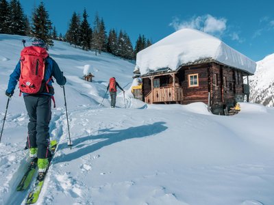
The Crans-Montana rando parc features 17 ski touring routes (green, blue, red, black) over more than 40 km of marked and secured trails with a positive elevation gain of 8,000 meters. The perfect route for those who are beginners or wish to practice ski touring without much effort, 210 m of positive elevation gain, all in forest. Magical!
Location
- Country CH
- State/Region Valais
- City 3963 Crans-Montana
- Latitude 46.308721
- Longitude 7.466830
Photos
Community Photos
Photos shared by community members
No community photos yet. Be the first to share!
Login to upload photosNo photos available for this track.
Additional Information
Parking: Parking available in Crans-Montana or at the start of the ski lifts.
Access: Access via Sierre by SMC bus or funicular. Closest stop: Crans-Montana, Télé Cry d'Er.
Safety: Routes are closed outside the operation hours of the ski lifts. Do not use in case of avalanche danger. EMERGENCY: 144.
Source
View Original SourceContact Information
Tourism and event organization for the Crans-Montana plateau
Contact Details
-
Address Avenue de la Gare 3
3963 Crans-Montana
CH -
Phone +41 27 485 04 04
-
Email contact@crans-montana.ch
-
Website Visit Website
Elevation Profile
Loading elevation data...
Track Conditions
No condition reports yet. Be the first to report!