Argentière / Lognan Refuge
Argentière, Haute-Savoie, FR
Min Elevation
1252m
Max Elevation
2079m
Elevation Gain
827m
Elevation Loss
-
Distance
5.0 km
Est. Time
2h30
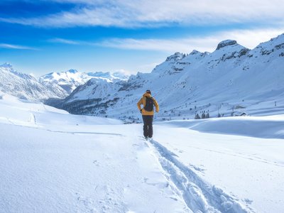
About this Track
Fairly technical route, not recommended for beginners. It goes up along the Pierre à Ric slope before branching off into the forest to reach the Chalet de Lognan. The descent is via the Pierre à Ric slope.
Location
- Country FR
- State/Region Haute-Savoie
- City 74400 Argentière
- Latitude 45.978380
- Longitude 6.929371
Photos
Community Photos
Photos shared by community members
No community photos yet. Be the first to share!
Login to upload photosNo photos available for this track.
Additional Information
Parking: 65 chemin de la Glacière, Argentière
Access: Departure from the village of Argentière, climbing along the Pierre à Ric slope.
Safety: Marked route, not maintained or secured. Good skiing level required for descent. Beacon/probe/shovel mandatory.
Source
View Original SourceContact Information
Office de Tourisme de la Vallée de Chamonix-Mont-Blanc
Auvergne-Rhône-AlpesMain tourism office for the Chamonix valley
Contact Details
-
Address 85 Place du Triangle de l'Amitié
74400 Chamonix-Mont-Blanc
FR -
Phone +33 (0)4 50 53 00 24
-
Email info@chamonix.com
-
Website Visit Website
Track Conditions
No condition reports yet. Be the first to report!