Djeu des Têtes Noires
Torgon, Valais, CH
Min Elevation
1141m
Max Elevation
1724m
Elevation Gain
829m
Elevation Loss
890m
Distance
7.4 km
Est. Time
3h35
About this Track
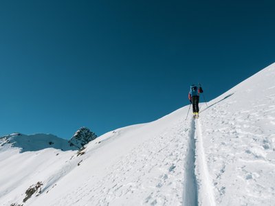
A magnificent walk for enthusiasts! This black route takes you to the Vieilles shelter up to the summit of la Jorette, passing through the Dravers alpine pasture. This route is perfect for a half-day outing. Enjoy the Plan de Croix facilities for a well-deserved break after your efforts.
Location
- Country CH
- State/Region Valais
- City 1899 Torgon
- Latitude 46.315016
- Longitude 6.851021
Photos
Community Photos
Photos shared by community members
No community photos yet. Be the first to share!
Login to upload photosNo photos available for this track.
Additional Information
Parking: Plan de Croix
Access: Plan de Croix
Safety: Demanding route. Consult the avalanche bulletin. Emergency equipment required.
Source
View Original SourceContact Information
Torgon Tourisme
ValaisTourism office for Torgon, gateway to the Portes du Soleil
Contact Details
-
Address Place de la Jorette
1899 Torgon
CH -
Phone +41 24 481 31 31
-
Email info@torgon.ch
-
Website Visit Website
Elevation Profile
Loading elevation data...
Track Conditions
No condition reports yet. Be the first to report!