Easy
Not provided
Last checked: 07/21/2026 18:04
Marked ski touring route: Plagne Bellecôte
La Plagne, Savoie, FR
Min Elevation
1930m
Max Elevation
2270m
Elevation Gain
340m
Elevation Loss
-
Distance
-
Est. Time
-
About this Track
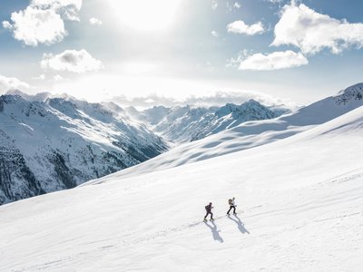
Marked route starting from Plagne Bellecôte using the Arolles and Leitchoums slopes for the ascent and the Ours slope for the descent. You can also start from Belle Plagne.
Location
- Country FR
- State/Region Savoie
- City 73210 La Plagne
- Latitude 45.512018
- Longitude 6.698295
Photos
Community Photos
Photos shared by community members
No community photos yet. Be the first to share!
Login to upload photosNo photos available for this track.
Additional Information
Parking: Plagne Bellecôte parking lots
Access: Inter-resort shuttles
Safety: Marked route.
Source
View Original SourceContact Information
Office de Tourisme de La Grande Plagne
Auvergne-Rhône-AlpesTourism office for La Plagne ski resort
Languages spoken
FR
EN
DE
Contact Details
-
Address B.P. 4
73210 Aime-la-Plagne
FR -
Phone +33 (0)4 79 09 02 01
-
Email info@la-plagne.com
-
Website Visit Website
Track Conditions
Please sign in to report track conditions.
No condition reports yet. Be the first to report!
1 / 0