Jorette Red
Torgon, Valais, CH
Min Elevation
1147m
Max Elevation
1637m
Elevation Gain
490m
Elevation Loss
-
Distance
2.1 km
Est. Time
1h50
About this Track
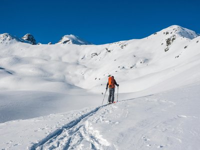
This is the most popular route among ski touring enthusiasts. Starting from the Torgon Tourism Office, the route offers a climb of 490m elevation gain to the summit of la Jorette. Once at the summit, enjoy a breathtaking view of Lake Geneva, the Dents du Midi and the Chablais plain. The descent is on an ungroomed slope, freeride enthusiasts will be delighted.
Location
- Country CH
- State/Region Valais
- City 1899 Torgon
- Latitude 46.314176
- Longitude 6.866952
Photos
Community Photos
Photos shared by community members
No community photos yet. Be the first to share!
Login to upload photosNo photos available for this track.
Additional Information
Parking: Torgon Tourism Office
Access: Torgon Tourism Office
Safety: Marked route. Consult the avalanche bulletin.
Source
View Original SourceContact Information
Torgon Tourisme
ValaisTourism office for Torgon, gateway to the Portes du Soleil
Contact Details
-
Address Place de la Jorette
1899 Torgon
CH -
Phone +41 24 481 31 31
-
Email info@torgon.ch
-
Website Visit Website
Elevation Profile
Loading elevation data...
Track Conditions
No condition reports yet. Be the first to report!