L'Élise-Allais
Combloux, Haute-Savoie, FR
Min Elevation
1459m
Max Elevation
1704m
Elevation Gain
190m
Elevation Loss
119m
Distance
1.2 km
Est. Time
45min
About this Track
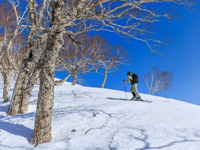
This route connects the bottom of the resort (the village) to the La Cry sector through a forest path and along the side of the slope. Ideal for a night outing (if authorized) or morning training.
Location
- Country FR
- State/Region Haute-Savoie
- City 74920 Combloux
- Latitude 45.870700
- Longitude 6.585330
Photos
Community Photos
Photos shared by community members
No community photos yet. Be the first to share!
Login to upload photosNo photos available for this track.
Additional Information
Parking: Tourism Office parking (village)
Access: Start near the village church
Safety: Check snow conditions at low altitude. Consult the avalanche bulletin.
Source
View Original SourceContact Information
Office de Tourisme de Combloux
Haute-SavoieTourism office for the village of Combloux
Contact Details
-
Address Place de l'Église
74700 Combloux
FR -
Phone +33 4 50 58 60 49
-
Email info@combloux.com
-
Website Visit Website
Elevation Profile
Loading elevation data...
Track Conditions
No condition reports yet. Be the first to report!