Maya Nivo Trail
Saint-Martin, Valais, CH
Min Elevation
1648m
Max Elevation
2281m
Elevation Gain
630m
Elevation Loss
5m
Distance
2.7 km
Est. Time
2h
About this Track
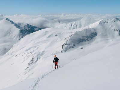
Discover an avalanche prevention trail with both practical and theoretical approaches. The route starts from Grange Neuve and climbs to the Loveignoz alpine pasture. 19 educational signs line the route to help you learn how to estimate local avalanche risks.
Location
- Country CH
- State/Region Valais
- City 1969 Saint-Martin
- Latitude 46.180061
- Longitude 7.445089
Photos
Community Photos
Photos shared by community members
No community photos yet. Be the first to share!
Login to upload photosNo photos available for this track.
Additional Information
Parking: Free parking available at Grange Neuve.
Access: Access via Saint-Martin, follow signs for Suen then Grange Neuve.
Safety: Check the avalanche bulletin before leaving. Safety equipment (transceiver, shovel, probe) strongly recommended.
Source
View Original SourceContact Information
Saint-Martin Tourisme
ValaisTourist information for the authentic village of Saint-Martin in Val d'Hérens
Contact Details
-
Address Le Village
1984 Saint-Martin
CH -
Phone +41 27 281 24 74
-
Email info@saint-martin.ch
-
Website Visit Website
Social Media
Opening Hours
Elevation Profile
Loading elevation data...
Track Conditions
No condition reports yet. Be the first to report!