La Chaux Blue Trail
Morgins, Valais, CH
Min Elevation
1698m
Max Elevation
1895m
Elevation Gain
200m
Elevation Loss
10m
Distance
2.2 km
Est. Time
30min
About this Track
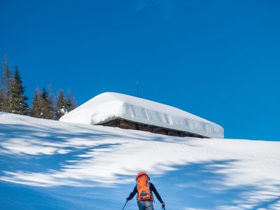
This short itinerary takes you to the top of the Foilleuse, passing by the newly-renovated Alpage de La Chaux restaurant where you can stop for magnificent views of the Dents du Midi and a bite to eat. Ski back down to Morgins via the Foilleuse slope.
Location
- Country CH
- State/Region Valais
- City 1875 Morgins
- Latitude 46.221503
- Longitude 6.863825
Photos
Community Photos
Photos shared by community members
No community photos yet. Be the first to share!
Login to upload photosNo photos available for this track.
Additional Information
Parking: Accessible via Savolaire Rando Parc trail or Chaux chairlift
Access: Start from Alpage de La Chaux
Safety: Trails marked but not patrolled. Carry avalanche safety equipment. Ski runs closed outside lift hours (before 8:30am, after 4:30pm) except Foilleuse (until 9:30pm).
Source
View Original SourceContact Information
Part of the Région Dents du Midi, focusing on Morgins and Portes du Soleil
Contact Details
-
Address Route de France 15
1875 Morgins
CH -
Phone +41 24 477 23 61
-
Email morgins@rddm.ch
-
Website Visit Website
Elevation Profile
Loading elevation data...
Track Conditions
No condition reports yet. Be the first to report!