1. Zamoureux (black)
Lens, Valais, CH
Min Elevation
1503m
Max Elevation
2260m
Elevation Gain
757m
Elevation Loss
22m
Distance
4.8 km
Est. Time
2h06
About this Track
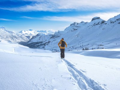
A route to Chetseron, with some lovely sections in the forest and a technical section at the top on the mountain bike downhill track, a surprising black route! Crans-Montana's ski touring park (“Rando Parc”) contains 17 ski touring itineraries (green, blue, red and black) spread across 40km of marked and secured trails and featuring a total ascent of 8'000 metres.
Location
- Country CH
- State/Region Valais
- City 1978 Lens
- Latitude 46.308615
- Longitude 7.466790
Photos
Community Photos
Photos shared by community members
No community photos yet. Be the first to share!
Login to upload photosNo photos available for this track.
Additional Information
Parking: Crans-Cry d'Er car park. Large paying car park with indoor (430) and outdoor (390) spaces. 24h/24. Address: Route des Téléphériques, 3963 Crans-Montana.
Access: Accessible from Sierre station with SMC buses or the funicular. Nearest stop: Crans-Montana, Télé Cry d'Er. By car, A9 motorway exit 'Sierre ouest', follow signs for Crans-Montana then cable cars.
Safety: Trails are closed outside lift operating hours. Danger of death (winch cat, avalanches). SOS: 144. Check status at www.crans-montana.ch/en/etat.
Source
View Original SourceContact Information
Tourism and event organization for the Crans-Montana plateau
Contact Details
-
Address Avenue de la Gare 3
3963 Crans-Montana
CH -
Phone +41 27 485 04 04
-
Email contact@crans-montana.ch
-
Website Visit Website
Elevation Profile
Loading elevation data...
Track Conditions
No condition reports yet. Be the first to report!