12. Vache Noire (black)
Crans-Montana, Valais, CH
Min Elevation
1514m
Max Elevation
2387m
Elevation Gain
873m
Elevation Loss
5m
Distance
4.2 km
Est. Time
2h08
About this Track
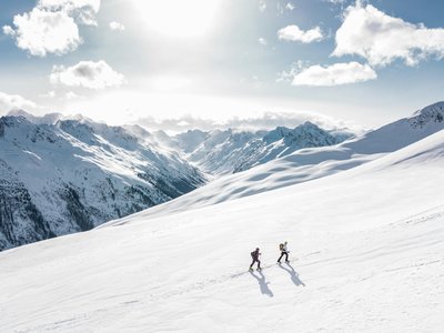
A fairly direct black route that climbs to the Vache Noire restaurant in Aminona, with technical sections in the forest, nice kick-turns (conversions) and an elevation gain of almost 900 metres. Crans-Montana's Rando Parc contains 17 ski touring itineraries across 40km of marked and secured trails.
Location
- Country CH
- State/Region Valais
- City 3963 Crans-Montana
- Latitude 46.332010
- Longitude 7.526203
Photos
Community Photos
Photos shared by community members
No community photos yet. Be the first to share!
Login to upload photosNo photos available for this track.
Additional Information
Parking: Aminona Parking (Route de l'Aminona, 3963 Crans-Montana). Free outdoor parking (100 spaces) and free indoor parking (350 spaces).
Access: Accessible via Sierre (SMC bus or funicular) or Sion (PostBus). Nearest stop: Crans-Montana, Aminona (bus 421 or 431).
Safety: Trails closed outside lift operating hours. Danger of death (winch cat grooming, avalanches). SOS: 144. Check status at www.crans-montana.ch/en/etat.
Source
View Original SourceContact Information
Tourism and event organization for the Crans-Montana plateau
Contact Details
-
Address Avenue de la Gare 3
3963 Crans-Montana
CH -
Phone +41 27 485 04 04
-
Email contact@crans-montana.ch
-
Website Visit Website
Elevation Profile
Loading elevation data...
Track Conditions
No condition reports yet. Be the first to report!