13. Petit Loup (green)
Crans-Montana, Valais, CH
Min Elevation
1514m
Max Elevation
1839m
Elevation Gain
325m
Elevation Loss
-
Distance
2.9 km
Est. Time
1h15
About this Track
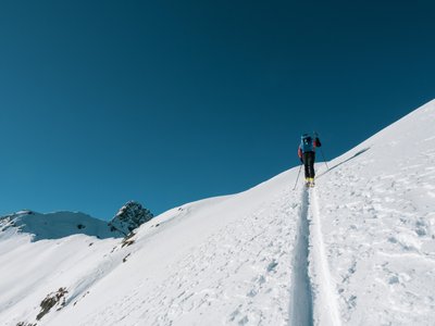
One of the original routes of the Rando Parc, accessible, easy, and which allows reaching the Colombire Alpine pasture by a wide path with a gentle slope. A perfect route for an introduction to ski mountaineering. The Crans-Montana rando park features 17 ski touring routes (green, blue, red, black) over more than 40km of marked and secured paths with a positive elevation gain of 8,000 meters.
Location
- Country CH
- State/Region Valais
- City 3963 Crans-Montana
- Latitude 46.331982
- Longitude 7.526185
Photos
Community Photos
Photos shared by community members
No community photos yet. Be the first to share!
Login to upload photosNo photos available for this track.
Additional Information
Parking: Aminona Parking: Route de l'Aminona, 3963 Crans-Montana. Free outdoor parking (100 spaces), free indoor parking (350 spaces).
Access: Accessible by SMC bus (line 421 or 431) to the Aminona stop. By car, A9 motorway exit 'Sierre est', follow signs for Crans-Montana then Aminona.
Safety: The activity is supervised during the opening hours of the ski area. Outside these hours, the routes are closed (danger of death: grooming machines with winches, avalanches). Emergency number: 144.
Source
View Original SourceContact Information
Tourism and event organization for the Crans-Montana plateau
Contact Details
-
Address Avenue de la Gare 3
3963 Crans-Montana
CH -
Phone +41 27 485 04 04
-
Email contact@crans-montana.ch
-
Website Visit Website
Elevation Profile
Loading elevation data...
Track Conditions
No condition reports yet. Be the first to report!