17. The X'Trème (black)
Lens, Valais, CH
Min Elevation
1504m
Max Elevation
2511m
Elevation Gain
2620m
Elevation Loss
1890m
Distance
23.2 km
Est. Time
7h05
About this Track
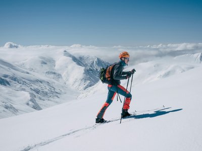
The Crans-Montana rando park has 17 ski touring routes (green, blue, red, black) over more than 40 km of marked and secured trails with a positive elevation gain of 8,000 meters. The merging of 3 routes (4, 8, and 12) for a complete discovery of the entire Ski Rando Parc domain, with a total of more than 2,600 meters of positive elevation gain. The great challenge with three ascents and 2620 m elevation gain! For experienced athletes.
Location
- Country CH
- State/Region Valais
- City 1978 Lens
- Latitude 46.308707
- Longitude 7.466787
Photos
Community Photos
Photos shared by community members
No community photos yet. Be the first to share!
Login to upload photosNo photos available for this track.
Additional Information
Parking: Parking Crans-Cry d'Er. Large paid parking with indoor spaces (430 places) and outdoor (390). Open 24/7.
Access: Accessible from Sierre train station with SMC buses or the funicular. Stop: Crans-Montana, Télé Cry d'Er. By car, A9 exit 'Sierre ouest', follow signs to Crans-Montana.
Safety: Check route openings at www.crans-montana.ch/etat. Danger of death outside operating hours due to grooming machines with winches. Emergency: 144.
Source
View Original SourceContact Information
Tourism and event organization for the Crans-Montana plateau
Contact Details
-
Address Avenue de la Gare 3
3963 Crans-Montana
CH -
Phone +41 27 485 04 04
-
Email contact@crans-montana.ch
-
Website Visit Website
Elevation Profile
Loading elevation data...
Track Conditions
No condition reports yet. Be the first to report!