Campeillots
Ax-les-Thermes, Occitanie, FR
Min Elevation
1400m
Max Elevation
1744m
Elevation Gain
344m
Elevation Loss
-
Distance
1.3 km
Est. Time
1h30
About this Track
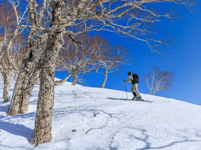
Explore the Campeillots route, a 1.3 km climb with mountain views. Access is only via the Sapin or Bonascre slopes then via the Crête de la Tute. Take the Savis slope descent, and at the intersection in front of 'La Belgerie', you will find the start. Follow the black markings. Average slope: 27%.
Location
- Country FR
- State/Region Occitanie
- City 09110 Ax-les-Thermes
- Latitude 42.699121
- Longitude 1.812098
Photos
Community Photos
Photos shared by community members
No community photos yet. Be the first to share!
Login to upload photosNo photos available for this track.
Additional Information
Parking: Plateau de Bonascre (special equipment mandatory depending on conditions)
Access: Access via Sapin/Bonascre + Crête de la Tute slopes. Departure at the Savis junction opposite the Belgerie.
Safety: Marked route. Respect the recommended hours (9:00 AM - 5:00 PM) and safety instructions. Dogs strictly prohibited. Consult the opening bulletin. Emergency: +33 5 61 05 40 31.
Source
View Original SourceContact Information
Contact Details
-
Address Station Ax 3 Domaines
09110 Ax-les-Thermes
FR -
Phone +33 5 61 64 20 06
-
Email contact@ax-ski.com
-
Website Visit Website
Track Conditions
No condition reports yet. Be the first to report!