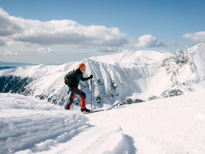
Saluces Pass
Vars, Hautes-Alpes, FR
Min Elevation
2130m
Max Elevation
2440m
Elevation Gain
310m
Elevation Loss
-
Distance
1.8 km
Est. Time
1h30
About this Track
At the top of the Télémix, take the blue slope which leads you to the start at the foot of the DVA park. At the start of the 'piste des heureux', you have arrived. It is time to enjoy a tidal wave of fresh air while gliding down the blue slope.
Location
- Country FR
- State/Region Hautes-Alpes
- City 05560 Vars
- Latitude 44.572685
- Longitude 6.678522
Photos
Community Photos
Photos shared by community members
No community photos yet. Be the first to share!
Login to upload photosNo photos available for this track.
Additional Information
Parking: Vars les Claux
Access: Summit of the Télémix de Chabrières, at the foot of the DVA park
Safety: Marked route. Max slope 20%. Consult the avalanche bulletin.
Source
View Original SourceContact Information
Vars Tourisme
Provence-Alpes-Côte d'AzurTourism Office for Vars La Forêt Blanche
Contact Details
-
Address Cours Fontanarosa
05560 Vars
FR -
Phone +33 (0)4 92 46 51 31
-
Email info@vars.com
-
Website Visit Website
Track Conditions
No condition reports yet. Be the first to report!