Diavolezza Challenge
Pontresina, Grisons, CH
Min Elevation
2084m
Max Elevation
2974m
Elevation Gain
890m
Elevation Loss
19m
Distance
4.8 km
Est. Time
2h15
About this Track
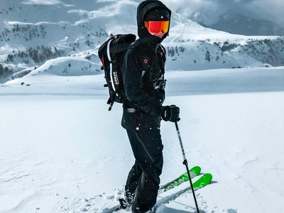
A permanently established, marked route for ski tourers leading from the valley station up to the Diavolezza mountain station. The route runs beside and away from the ski slope. It is a pioneer project offering a safe training environment. Luggage transport to the top is included with the special ticket. Descent is via the regular ski slopes.
Location
- Country CH
- State/Region Grisons
- City 7504 Pontresina
- Latitude 46.441280
- Longitude 9.982479
Photos
Community Photos
Photos shared by community members
No community photos yet. Be the first to share!
Login to upload photosNo photos available for this track.
Additional Information
Parking: Large car park at Diavolezza valley station
Access: By Rhaetian Railway (RhB) or bus to 'Bernina Diavolezza' stop.
Safety: Route closed outside cable car hours (danger to life from winches/avalanche blasting). LVS, probe, and shovel required. Descent on ascent route is prohibited.
Source
View Original SourceContact Information
Diavolezza Lagalb AG
GraubündenOperator of the cable car and ski area in the Engadin valley
Contact Details
-
Address Talstation Diavolezza
7504 Pontresina
CH -
Phone +41 81 838 73 73
-
Email info@diavolezza.ch
-
Website Visit Website
Elevation Profile
Loading elevation data...
Track Conditions
No condition reports yet. Be the first to report!