Ski touring route: Montalbert 1600 - Le Fornelet
Plagne-Montalbert, Savoie, FR
Min Elevation
1634m
Max Elevation
1975m
Elevation Gain
375m
Elevation Loss
569m
Distance
3.0 km
Est. Time
-
About this Track
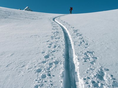
A route to become familiar with ski touring techniques. A beautiful forest route ending at the summit of Fornelet with a splendid view. Follows the snowshoe trail of Bois des Fornettes.
Location
- Country FR
- State/Region Savoie
- City 73210 Plagne-Montalbert
- Latitude 45.516630
- Longitude 6.650126
Photos
Community Photos
Photos shared by community members
No community photos yet. Be the first to share!
Login to upload photosNo photos available for this track.
Additional Information
Parking: Plagne Montalbert
Access: Plagne Montalbert
Safety: Descent recommended via the 'Montalbert' blue slope. Ungroomed route.
Source
View Original SourceContact Information
Office de Tourisme de La Grande Plagne
Auvergne-Rhône-AlpesTourism office for La Plagne ski resort
Contact Details
-
Address B.P. 4
73210 Aime-la-Plagne
FR -
Phone +33 (0)4 79 09 02 01
-
Email info@la-plagne.com
-
Website Visit Website
Elevation Profile
Loading elevation data...
Track Conditions
No condition reports yet. Be the first to report!