La Faysse
Montricher-Albanne, Savoie, FR
Min Elevation
1600m
Max Elevation
2245m
Elevation Gain
645m
Elevation Loss
-
Distance
1.9 km
Est. Time
-
About this Track
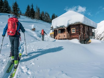
The La Faysse route uses a marked summer path through the locality of the same name. It ensures safe ski touring by channeling flows away from the downhill slopes. The route has an average gradient of 21%, with an intermediate point at 410 meters of elevation gain ideal for beginners. The descent is made on the groomed red runs of Les Vordaches and Les Embrumes.
Location
- Country FR
- State/Region Savoie
- City 73870 Montricher-Albanne
- Latitude 45.234100
- Longitude 6.398600
Photos
Community Photos
Photos shared by community members
No community photos yet. Be the first to share!
Login to upload photosNo photos available for this track.
Additional Information
Parking: Les Karellis Resort
Access: Route accessible without ski lifts
Safety: Marked route. Requires good physical condition and mountain safety knowledge (avalanches).
Source
View Original SourceContact Information
Office de Tourisme des Karellis
Auvergne-Rhône-AlpesTourism office for the unique car-free resort of Les Karellis
Contact Details
-
Address Le Forum
73870 Montricher-Albanne
FR -
Phone +33 4 79 59 50 36
-
Email info@karellis.com
-
Website Visit Website
Track Conditions
No condition reports yet. Be the first to report!