Sibières Track
Vars, Hautes-Alpes, FR
Min Elevation
1850m
Max Elevation
2175m
Elevation Gain
325m
Elevation Loss
-
Distance
2.2 km
Est. Time
-
About this Track
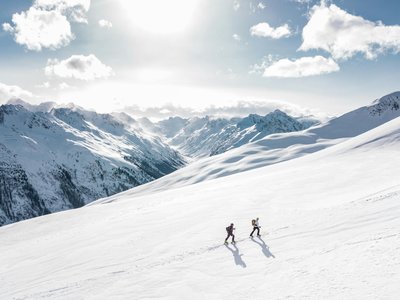
Final wild section in the small valleys, facing Eyssina and the freeride couloirs. A sporty route, 70% in the forest, in immediate proximity to the slopes. This ski touring course is ideal for mountain experts seeking challenges.
Location
- Country FR
- State/Region Hautes-Alpes
- City 05560 Vars
- Latitude 44.566300
- Longitude 6.685043
Photos
Community Photos
Photos shared by community members
No community photos yet. Be the first to share!
Login to upload photosNo photos available for this track.
Additional Information
Parking: Vars les Claux, Fournet / Rail sled
Access: Start: Vars les Claux, Fournet / Rail sled. Finish: summit of the Sibières chairlift.
Safety: Ungroomed route. May be closed depending on weather conditions and avalanche risk.
Source
View Original SourceContact Information
Vars Tourisme
Provence-Alpes-Côte d'AzurTourism Office for Vars La Forêt Blanche
Contact Details
-
Address Cours Fontanarosa
05560 Vars
FR -
Phone +33 (0)4 92 46 51 31
-
Email info@vars.com
-
Website Visit Website
Track Conditions
No condition reports yet. Be the first to report!