Le Fay – Mont Reguet n°10
Flumet, Savoie, FR
Min Elevation
967m
Max Elevation
1443m
Elevation Gain
280m
Elevation Loss
120m
Distance
3.2 km
Est. Time
2h45
About this Track
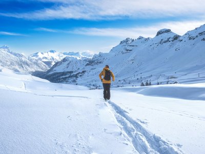
Departing from La Frassette, the climb begins in open terrain before an irregular forest section then a wide track. Departure from the old Fay ski lift (950m). Go up along the ski lift to the summit (1080m) from the left. Follow the yellow markings in the forest.
Location
- Country FR
- State/Region Savoie
- City 73590 Flumet
- Latitude 45.821024
- Longitude 6.530058
Photos
Community Photos
Photos shared by community members
No community photos yet. Be the first to share!
Login to upload photosNo photos available for this track.
Additional Information
Parking: Parking at La Frassette
Access: Departure from the old Fay ski lift
Safety: Avalanche safety equipment required.
Source
View Original SourceContact Information
Office de Tourisme du Val d'Arly
Auvergne-Rhône-AlpesTourism office for the Val d'Arly region (Flumet, ND de Bellecombe, Crest-Voland, Cohennoz)
Contact Details
-
Address Route des Aravis
73590 Flumet
FR -
Phone +33 4 79 31 06 82
-
Website Visit Website
Elevation Profile
Loading elevation data...
Track Conditions
No condition reports yet. Be the first to report!