Le Rosset
Pralognan-la-Vanoise, Savoie, FR
Min Elevation
1983m
Max Elevation
2336m
Elevation Gain
150m
Elevation Loss
17m
Distance
-
Est. Time
-
About this Track
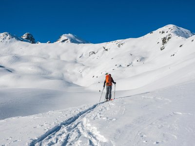
This route is located at the bottom of the ski area. It is ideal for learning ski touring in complete safety on a marked route before tackling routes with more elevation gain.
Location
- Country FR
- State/Region Savoie
- City 73710 Pralognan-la-Vanoise
- Latitude 45.386703
- Longitude 6.733665
Photos
Community Photos
Photos shared by community members
No community photos yet. Be the first to share!
Login to upload photosNo photos available for this track.
Additional Information
Parking: Bouquetin parking lot
Access: From the village center, head towards the snow front.
Safety: Marked route. Check the opening status of the slopes before starting.
Source
View Original SourceContact Information
Office de Tourisme de Pralognan-la-Vanoise
Auvergne-Rhône-AlpesTourism office for the mountain village of Pralognan-la-Vanoise
Contact Details
-
Address Route de la Vanoise
73710 Pralognan-la-Vanoise
FR -
Phone +33 (0)4 79 08 79 08
-
Email info@pralognan.com
-
Website Visit Website
Elevation Profile
Loading elevation data...
Track Conditions
No condition reports yet. Be the first to report!