Molines-en-Queyras
Molines-en-Queyras, Hautes-Alpes, FR
Min Elevation
1749m
Max Elevation
2164m
Elevation Gain
415m
Elevation Loss
-
Distance
2.3 km
Est. Time
2h
About this Track
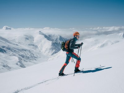
A marked route starting from the Molines resort, pure bliss! With your safety equipment (transceiver, shovel, probe), a beautiful climb awaits you, a chance to work up a sweat before descending on the groomed slope!
Location
- Country FR
- State/Region Hautes-Alpes
- City 05350 Molines-en-Queyras
- Latitude 44.720247
- Longitude 6.848031
Photos
Community Photos
Photos shared by community members
No community photos yet. Be the first to share!
Login to upload photosNo photos available for this track.
Additional Information
Parking: Molines-en-Queyras resort
Access: Departure Molines-en-Queyras
Safety: Unsecured routes. Avalanche transceiver, shovel, probe mandatory. Closed during avalanche risk levels 4 and 5.
Source
View Original SourceContact Information
Office de Tourisme du Guillestrois et du Queyras
Provence-Alpes-Côte d'AzurTourism Office for the Guillestrois and Queyras region
Contact Details
-
Address Maison du Tourisme
05350 Château-Ville-Vieille
FR -
Phone +33 4 92 46 76 18
-
Website Visit Website
Elevation Profile
Loading elevation data...
Track Conditions
No condition reports yet. Be the first to report!