New start 24-25: Pont de Bachat-Bouloud - Croix de Chamrousse
Chamrousse, Isère, FR
Min Elevation
1731m
Max Elevation
2247m
Elevation Gain
523m
Elevation Loss
-
Distance
3.5 km
Est. Time
2h30
About this Track
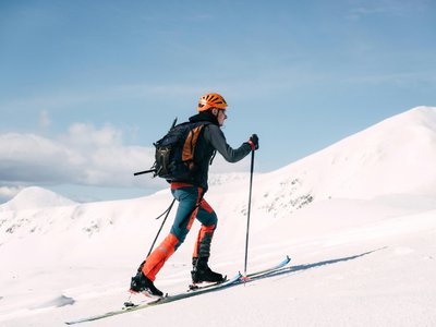
Difficult ski touring climb to the Croix, approx. 3.5 km long. Mainly forest route starting from Pont de Bachat-Bouloud, with alpine sections. Two possible escape routes. Descent possible via alpine ski slopes (red or blue).
Location
- Country FR
- State/Region Isère
- City 38410 Chamrousse
- Latitude 45.104776
- Longitude 5.876505
Photos
Community Photos
Photos shared by community members
No community photos yet. Be the first to share!
Login to upload photosNo photos available for this track.
Additional Information
Parking: Recommended parking 800/900 meters away on Avenue du Père Tasse.
Access: Bachat Bridge: put on skis at the Ecrin chairlift, then cross to the other side of the slope.
Safety: Unsecured. Do not descend via alpine slopes at night (winch grooming from 6pm to 8:30am).
Source
View Original SourceContact Information
Chamrousse Tourisme
Auvergne-Rhône-AlpesOffice of Tourism for the Chamrousse ski resort, near Grenoble
Contact Details
-
Address 42 place de Belledonne
38410 Chamrousse
FR -
Phone +33 4 76 89 92 65
-
Email info@chamrousse.com
-
Website Visit Website
Elevation Profile
Loading elevation data...
Track Conditions
No condition reports yet. Be the first to report!