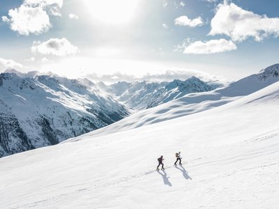
Schlossalm-Kamin
Bad Hofgastein, Salzburg, AT
Min Elevation
844m
Max Elevation
2073m
Elevation Gain
1218m
Elevation Loss
2m
Distance
5.6 km
Est. Time
2h30
About this Track
The route follows the former 'Kamin' descent after the railway viaduct. It then connects to the summer path towards the Haitzingalm reservoir and merges with the Schlossalm-Aeroplan tour to end at the Kleine Scharte station.
Location
- Country AT
- State/Region Salzburg
- City 5630 Bad Hofgastein
- Latitude 47.166510
- Longitude 13.098190
Photos
Community Photos
Photos shared by community members
No community photos yet. Be the first to share!
Login to upload photosNo photos available for this track.
Additional Information
Parking: Schlossalmbahn parking lot, Bad Hofgastein
Access: Start after the railway viaduct, heading south
Safety: Use permitted only during slope opening hours. Ski pass or touring ticket required.
Source
View Original SourceContact Information
Gasteiner Bergbahnen AG
SalzburgLift operator for the Gastein Valley ski area
Contact Details
-
Address Bundesstraße 567
5630 Bad Hofgastein
AT -
Phone +43 6432 6455
-
Email info@skigastein.com
-
Website Visit Website
Elevation Profile
Loading elevation data...
Track Conditions
No condition reports yet. Be the first to report!