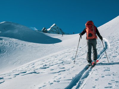
Vallée Blanche N°4
Les Deux Alpes, Isère, FR
Min Elevation
-
Max Elevation
-
Elevation Gain
480m
Elevation Loss
-
Distance
4.5 km
Est. Time
2h
About this Track
This marked and secured (but ungroomed) ski touring route is a loop in the Vallée Blanche sector. The start is at the foot of the Vallée Blanche chairlift (1650m). The ascent follows a dedicated track, and the descent is via the alpine ski slopes to return to the starting point.
Location
- Country FR
- State/Region Isère
- City 38860 Les Deux Alpes
- Latitude 45.006539
- Longitude 6.119518
Photos
Community Photos
Photos shared by community members
No community photos yet. Be the first to share!
Login to upload photosNo photos available for this track.
Additional Information
Parking: Les Deux Alpes resort car parks
Access: Access from the foot of the Vallée Blanche chairlift
Safety: Marked route. Do not use outside the opening hours of the ski area. Check weather conditions and opening status.
Source
View Original SourceContact Information
Contact Details
-
Phone +33 (0)4 76 79 22 00
-
Email info@les2alpes.com
Elevation Profile
Loading elevation data...
Track Conditions
No condition reports yet. Be the first to report!