Milky Way
Allos, Alpes-de-Haute-Provence, FR
Min Elevation
1576m
Max Elevation
2398m
Elevation Gain
848m
Elevation Loss
100m
Distance
7.0 km
Est. Time
4h30
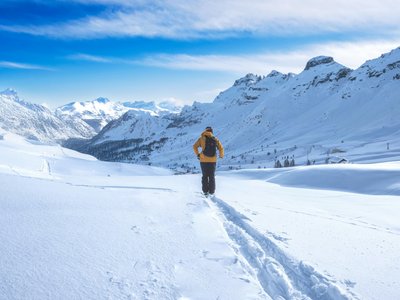
About this Track
The longest and most exotic route in the Seignus d'Allos resort. A route for regular practitioners offering magnificent panoramas, moving through a larch forest, alpine meadows, and ending on the ridges, far from the ski lifts.
Location
- Country FR
- State/Region Alpes-de-Haute-Provence
- City 04260 Allos
- Latitude 44.241780
- Longitude 6.608330
Photos
Community Photos
Photos shared by community members
No community photos yet. Be the first to share!
Login to upload photosNo photos available for this track.
Additional Information
Parking: Parking des Champons, Allos
Access: Seignus d'Allos
Safety: Off-piste route marked with yellow signs. Safety equipment mandatory.
Source
View Original SourceContact Information
Contact Details
-
Phone +33 4 92 83 02 81
-
Email info@valdallos.com
Elevation Profile
Loading elevation data...
Track Conditions
No condition reports yet. Be the first to report!