4. St-Luc: Pluton
Saint-Luc, Valais, CH
Min Elevation
1694m
Max Elevation
3020m
Elevation Gain
1400m
Elevation Loss
17m
Distance
10.0 km
Est. Time
3h26
About this Track
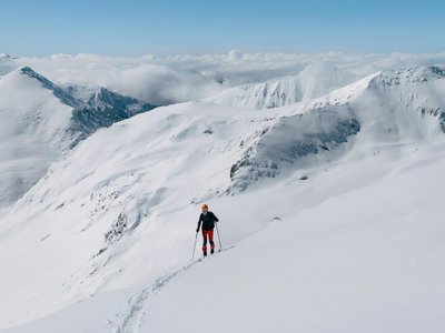
A trail tailored for experienced hikers: nearly 1400m of elevation gain. The path goes via lakes Combavert and Bella Tola up to the summit of Bella Tola at over 3000m.
Location
- Country CH
- State/Region Valais
- City 3961 Saint-Luc
- Latitude 46.217954
- Longitude 7.611850
Photos
Community Photos
Photos shared by community members
No community photos yet. Be the first to share!
Login to upload photosNo photos available for this track.
Additional Information
Parking: Le Prilet parking in St-Luc.
Access: Start on the Prilet slope, following the Roua torrent.
Safety: Last ascent on foot secured by ropes. High physical level required.
Source
View Original SourceContact Information
Sierre-Anniviers Marketing
ValaisMarketing organization for the Sierre and Val d'Anniviers region
Contact Details
-
Address Place de la Gare 10
3960 Sierre
CH -
Phone +41 27 452 23 23
-
Email info@sierre-anniviers.ch
-
Website Visit Website
Elevation Profile
Loading elevation data...
Track Conditions
No condition reports yet. Be the first to report!