6. L'Arnou d'Er (red)
Lens, Valais, CH
Min Elevation
1714m
Max Elevation
2260m
Elevation Gain
546m
Elevation Loss
16m
Distance
3.9 km
Est. Time
1h38
About this Track
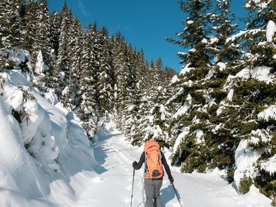
The Crans-Montana rando park has 17 ski touring routes (green, blue, red, black) over more than 40 km of marked and secured trails for a positive elevation gain of 8,000 meters. Starting from Arnouva, this route passes near the Corbyre alpine pasture before joining the trail that climbs to Chetseron and finishing at Cry d'Er.
Location
- Country CH
- State/Region Valais
- City 1978 Lens
- Latitude 46.317777
- Longitude 7.477462
Photos
Community Photos
Photos shared by community members
No community photos yet. Be the first to share!
Login to upload photosNo photos available for this track.
Additional Information
Parking: Signal Parking (Route de Vermala) or Stephani Parking (Rue Théodore Stéfani, 140 paid indoor spaces).
Access: Take the A9 motorway to Sierre West, follow signs for Crans-Montana. Use the lifts to reach Arnouva (starting point). Accessible via free SMC shuttles (stop: Télé Arnouva).
Safety: Routes secured only during lift operating hours. Closed outside these hours (danger of death: grooming machines with winches, avalanches). Emergency: 144.
Source
View Original SourceContact Information
Tourism and event organization for the Crans-Montana plateau
Contact Details
-
Address Avenue de la Gare 3
3963 Crans-Montana
CH -
Phone +41 27 485 04 04
-
Email contact@crans-montana.ch
-
Website Visit Website
Elevation Profile
Loading elevation data...
Track Conditions
No condition reports yet. Be the first to report!