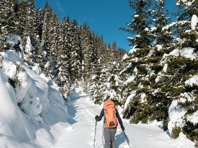
Au fil de l'Aup - Flaine
Magland, Haute-Savoie, FR
Min Elevation
1579m
Max Elevation
2193m
Elevation Gain
600m
Elevation Loss
55m
Distance
4.6 km
Est. Time
-
About this Track
A beautiful route in Flaine following the Aup ridge. With 600m of positive elevation, this itinerary is for regular hikers. The view at the summit of the Desert de Platé is magnificent.
Location
- Country FR
- State/Region Haute-Savoie
- City 74300 Magland
- Latitude 46.003010
- Longitude 6.691170
Photos
Community Photos
Photos shared by community members
No community photos yet. Be the first to share!
Login to upload photosNo photos available for this track.
Additional Information
Parking: Flaine resort parking
Access: Access via ski lifts or from the resort base
Safety: Weather conditions can change rapidly above 2000m.
Source
View Original SourceContact Information
Contact Details
-
Phone +33 (0)4 50 90 80 01
-
Email welcome@flaine.com
Elevation Profile
Loading elevation data...
Track Conditions
No condition reports yet. Be the first to report!