Cassiopée
Allos, Alpes-de-Haute-Provence, FR
Min Elevation
1863m
Max Elevation
2399m
Elevation Gain
587m
Elevation Loss
90m
Distance
4.6 km
Est. Time
2h30
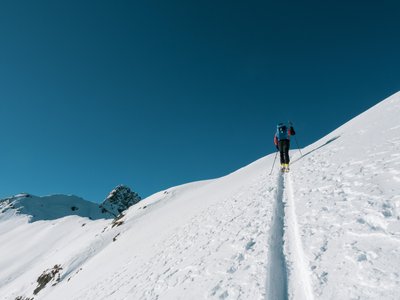
About this Track
Ski touring route starting from Seignus d'Allos up to the summit of l'Autapie. A technical and exciting course. You will travel through different landscapes ranging from larch undergrowth to alpine meadows, finishing with the ridges and their 360-degree panorama. A bit technical, this route makes you appreciate the joys of ski touring.
Location
- Country FR
- State/Region Alpes-de-Haute-Provence
- City 04260 Allos
- Latitude 44.229140
- Longitude 6.611060
Photos
Community Photos
Photos shared by community members
No community photos yet. Be the first to share!
Login to upload photosNo photos available for this track.
Additional Information
Parking: None
Access: Departure from the Fond Frede chairlift, Allos
Safety: Off-piste route; to be taken under your own responsibility. Carry safety equipment (transceiver, shovel, probe). Consult the Avalanche Risk Bulletin (BRA).
Source
View Original SourceContact Information
Contact Details
-
Phone +33 4 92 83 02 81
-
Email info@valdallos.com
Elevation Profile
Loading elevation data...
Track Conditions
No condition reports yet. Be the first to report!