Santa Claus Path n°5
Notre-Dame-de-Bellecombe, Savoie, FR
Min Elevation
1140m
Max Elevation
1443m
Elevation Gain
334m
Elevation Loss
37m
Distance
2.2 km
Est. Time
2h15
About this Track
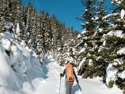
Starting from the Verdette ski lift, the climb begins in mountain pastures before a forested section then a wide track. Follow the yellow markers in the woods to reach a forest track to the ski lift.
Location
- Country FR
- State/Region Savoie
- City 73590 Notre-Dame-de-Bellecombe
- Latitude 45.813407
- Longitude 6.521103
Photos
Community Photos
Photos shared by community members
No community photos yet. Be the first to share!
Login to upload photosNo photos available for this track.
Additional Information
Parking: None
Access: 167 rue de Savoie, 73590 Notre-Dame-de-Bellecombe
Safety: Subject to favorable snow and weather conditions.
Source
View Original SourceContact Information
Office de Tourisme du Val d'Arly
Auvergne-Rhône-AlpesTourism office for the Val d'Arly region (Flumet, ND de Bellecombe, Crest-Voland, Cohennoz)
Contact Details
-
Address Route des Aravis
73590 Flumet
FR -
Phone +33 4 79 31 06 82
-
Website Visit Website
Elevation Profile
Loading elevation data...
Track Conditions
No condition reports yet. Be the first to report!