Mélézet Route
Risoul, Hautes-Alpes, FR
Min Elevation
1850m
Max Elevation
2200m
Elevation Gain
350m
Elevation Loss
-
Distance
-
Est. Time
-
About this Track
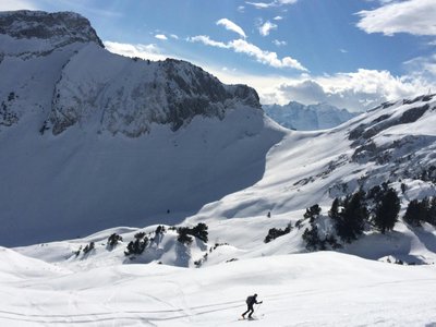
Starting from Risoul 1850, this route takes you to the top of the Mélézet chairlift at 2200 m. The trail is set in the heart of a beautiful larch forest with several viewpoints overlooking the resort. The ascent follows the snowshoe path to the Vallon du Mélézet road, then follows specific ski touring signs. For the descent, you can use the blue or red slopes.
Location
- Country FR
- State/Region Hautes-Alpes
- City 05600 Risoul
- Latitude 44.622397
- Longitude 6.632570
Photos
Community Photos
Photos shared by community members
No community photos yet. Be the first to share!
Login to upload photosNo photos available for this track.
Additional Information
Parking: Risoul 1850 resort car parks
Access: Go to the snow front, then head towards the Skiséô aquatic center.
Safety: Marked routes. Use only during opening hours (8:30 AM - 5:00 PM). Check avalanche risks.
Source
View Original SourceContact Information
Office de Tourisme de Risoul
Provence-Alpes-Côte d'AzurTourism Office for Risoul 1850
Contact Details
-
Address Front de Neige
05600 Risoul
FR -
Phone +33 4 92 46 02 60
-
Email info@risoul.com
-
Website Visit Website
Track Conditions
No condition reports yet. Be the first to report!