Ski touring route - Le Tour
Argentière, Haute-Savoie, FR
Min Elevation
1462m
Max Elevation
1850m
Elevation Gain
388m
Elevation Loss
-
Distance
-
Est. Time
1h30
About this Track
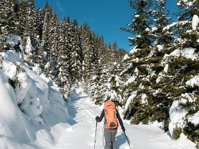
This marked route allows for the discovery of the discipline. The track follows the Caisets slope to the summit of Charamillon, offering a splendid view of the Chamonix Mont-Blanc Valley. The descent is via the ski slope.
Location
- Country FR
- State/Region Haute-Savoie
- City 74400 Argentière
- Latitude 46.004216
- Longitude 6.948533
Photos
Community Photos
Photos shared by community members
No community photos yet. Be the first to share!
Login to upload photosNo photos available for this track.
Additional Information
Parking: Parking at the foot of the Charamillon gondola, Le Tour
Access: Departure at the foot of the Charamillon gondola, next to the Hotel l'Olympique. Bus stop: Le Tour
Safety: Marked route, not maintained or secured. Beacon/probe/shovel recommended. Check conditions beforehand.
Source
View Original SourceContact Information
Office de Tourisme de la Vallée de Chamonix-Mont-Blanc
Auvergne-Rhône-AlpesMain tourism office for the Chamonix valley
Contact Details
-
Address 85 Place du Triangle de l'Amitié
74400 Chamonix-Mont-Blanc
FR -
Phone +33 (0)4 50 53 00 24
-
Email info@chamonix.com
-
Website Visit Website
Track Conditions
No condition reports yet. Be the first to report!