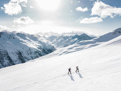
La Ravine à Claudius
Combloux, Haute-Savoie, FR
Min Elevation
1359m
Max Elevation
1579m
Elevation Gain
210m
Elevation Loss
28m
Distance
1.5 km
Est. Time
45min
About this Track
Small route ideal for initiation or a quick outing after work. The track winds gently through the forest, offering a bubble of calm far from the hustle and bustle of the main slopes. Perfect for testing your equipment or learning the basics of kick turns.
Location
- Country FR
- State/Region Haute-Savoie
- City 74920 Combloux
- Latitude 45.883770
- Longitude 6.619310
Photos
Community Photos
Photos shared by community members
No community photos yet. Be the first to share!
Login to upload photosNo photos available for this track.
Additional Information
Parking: La Cry or Les Brunnets parking lot
Access: Easy access from the La Cry parking lot.
Safety: Proximity route, please respect the specific ski touring marking.
Source
View Original SourceContact Information
Contact Details
-
Address Place de l'Église
74700 Combloux
FR -
Phone +33 4 50 58 60 49
-
Email info@combloux.com
-
Website Visit Website
Elevation Profile
Loading elevation data...
Track Conditions
No condition reports yet. Be the first to report!