La Trace - Start 1550 (Champ Lacas)
Les Orres, Hautes-Alpes, FR
Min Elevation
1552m
Max Elevation
1751m
Elevation Gain
700m
Elevation Loss
8m
Distance
4.8 km
Est. Time
4h10
About this Track
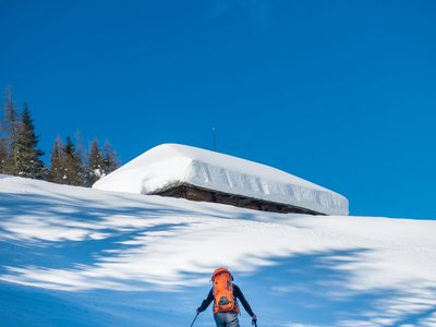
Discover our medium-level ski touring trail, set between clearings and forests. Head up towards the Grand-Clos water reserve. Pay close attention to the markings, as there are many paths in this area. The route offers a breathtaking panorama of the Parpaillon massif and the Ecrins.
Location
- Country FR
- State/Region Hautes-Alpes
- City 05200 Les Orres
- Latitude 44.500387
- Longitude 6.556312
Photos
Community Photos
Photos shared by community members
No community photos yet. Be the first to share!
Login to upload photosNo photos available for this track.
Additional Information
Parking: Champ-Lacas parking lot
Access: Park at the Champ-Lacas parking lot and put your skis on at the start of the Charance snowshoe trail.
Safety: Ungroomed and unsecured route. Carry your safety equipment (Aver-shovel-probe). Be careful when crossing ski slopes.
Source
View Original SourceContact Information
Office de Tourisme des Orres
Provence-Alpes-Côte d'AzurTourism Office for Les Orres ski resort
Contact Details
-
Address Place des Étoiles
05200 Les Orres
FR -
Phone +33 (0)4 92 44 01 61
-
Email info@lesorres.com
-
Website Visit Website
Elevation Profile
Loading elevation data...
Track Conditions
No condition reports yet. Be the first to report!