Le Bettex / Sous les Freddys
Saint-Gervais-les-Bains, Haute-Savoie, FR
Min Elevation
1390m
Max Elevation
1736m
Elevation Gain
332m
Elevation Loss
-
Distance
3.4 km
Est. Time
1h15
About this Track
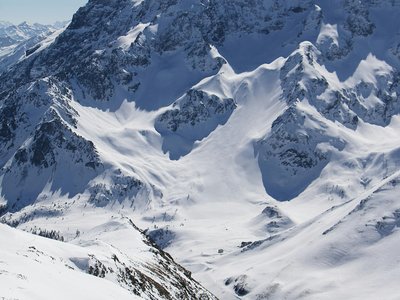
An accessible and varied route starting from the Bettex snow front. Climb through the Crêt Mortet forest to reach the magnificent Sous les Freddys alpine pasture with its typical chalet and panoramic view of Mont-Blanc.
Location
- Country FR
- State/Region Haute-Savoie
- City 74170 Saint-Gervais-les-Bains
- Latitude 45.874073
- Longitude 6.685596
Photos
Community Photos
Photos shared by community members
No community photos yet. Be the first to share!
Login to upload photosNo photos available for this track.
Additional Information
Parking: Nearby parking
Access: Departure: Bettex snow front
Safety: Route not secured outside opening hours. Inquire about avalanche risk.
Source
View Original SourceContact Information
Office de tourisme de Saint-Gervais Mont-Blanc
Auvergne-Rhône-AlpesTourism Office for Saint-Gervais Mont-Blanc
Contact Details
-
Address 43 rue du Mont-Blanc
74170 Saint-Gervais-les-Bains
FR -
Phone +33 4 50 47 76 08
-
Website Visit Website
Elevation Profile
Loading elevation data...
Track Conditions
No condition reports yet. Be the first to report!