N°2 - Saint Guérin
Sainte-Foy-Tarentaise, Savoie, FR
Min Elevation
1524m
Max Elevation
1938m
Elevation Gain
485m
Elevation Loss
485m
Distance
3.7 km
Est. Time
2h30
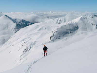
About this Track
Ski touring route starting from the resort (Bataillette sector) which allows you to reach the Saint Guérin chapel above the start of the Marquise chairlift. Descent possible via the Grand Solliet, Chapelle, and Charmettes slopes.
Location
- Country FR
- State/Region Savoie
- City 73640 Sainte-Foy-Tarentaise
- Latitude 45.578520
- Longitude 6.894050
Photos
Community Photos
Photos shared by community members
No community photos yet. Be the first to share!
Login to upload photosNo photos available for this track.
Additional Information
Parking: Bataillette sector
Access: Departure from the Bataillette sector
Safety: Check openings before departure, especially in case of avalanche triggering operations (PIDA). Descent possible during ski area opening hours.
Source
View Original SourceContact Information
Sainte Foy Tarentaise Tourisme
Auvergne-Rhône-AlpesTourism office for the Sainte Foy Tarentaise ski resort
Contact Details
-
Address 130 Placette du Brenzet
73640 Sainte-Foy-Tarentaise
FR -
Phone +33 (0)4 79 06 95 19
-
Email info@saintefoy.net
-
Website Visit Website
Elevation Profile
Loading elevation data...
Track Conditions
No condition reports yet. Be the first to report!